Visual database
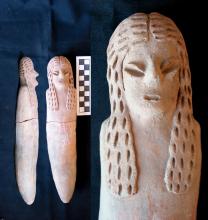
"Two-Braid Woman" depicted on a musical instrument, Rio Muerto M70 cemetery.
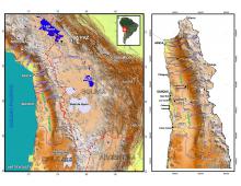
(a) Maps of the southern Andes, showing its environmental/cultural subregions, its geographic features, and modern national boundaries. The Tarapacá Area in the Western Valley Region of the north of Chile is emphasized, with many of the archaeological sites discussed in the text located. The Pampa del Tamarugal stretches across this vast internal drainage basin south of the Quebrada de Tana or Camiña as far south as the Río Loa. (b) Map of the Tarapacá region in the north of Chile indicating the main sites discussed in the text. The Pampa del Tamarugal stretches across the vast internal drainage basin south of the Quebrada de Tana or Camiña as far as the Río Loa.
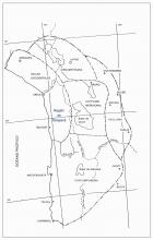
Map of the Tarapacá region in the north of Chile indicating the main sites discussed in the text. The Pampa del Tamarugal stretches across the vast internal drainage basin south of the Quebrada de Tana or Camiña as far as the Río Loa.
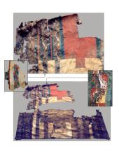
Tunic T3/SM from Tr-40B. Tiwanaku style.
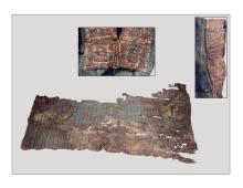
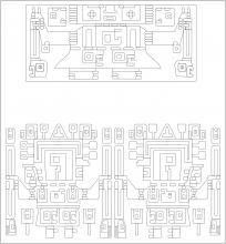
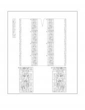
(a) Tunic T5/SS from Tr-40B, Tiwanaku style; (b) embroideries at the bottom of the neck slot of tunic T3/SS (top) and tunic T5/SS (bottom). Drawings based on those of Oakland (2000).
embroideries at the bottom of the neck slot of tunic T3/SS (top) and tunic T5/SS (bottom). Drawings based on those of Oakland (2000).
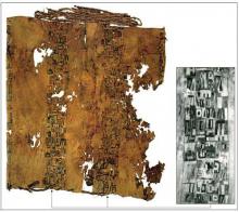
Tunic from Grave 7, Section G of Pica 8. Tiwanaku Provincial style.
Drawing of the Tunic from Grave 7, Section G of Pica 8. Detail of the module motifs.
