22.1
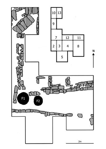
Excavation map showing features 1 (F1) and 2 (F2) as well as wall foundations of the building partially excavated during the years 2004 to 2006. Excavation unit locations and numbers are shown at a smaller scale above. Drawing by Antti Korpisaari.
Item record
Chapter
Ch. 22: Snake, Fish, and Toad/Frog Iconography in the Ceramic Caches of Pariti, Bolivia
Item type
Drawing
Creator
Cultural terms
Tiwanaku
Geographic terms
Pariti Island
Temporal terms
Tiwanaku V
Image contents
Material
Object
Reuse
Copyright holder
Antti Korpisaari
Recommended citation
Isbell, William H.; Uribe, Mauricio I.; Tiballi, Anne; Edward P. Zegarra, 2018, "Visual database", https://doi.org/10.25346/S6/1B33FN.

