3.4
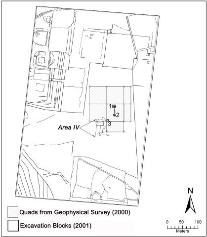
Map of the central ceremonial district with areas indicated from the geophysical survey (2000), recent excavations (2001), and Kidder's Area IV excavation (1939) on the Central Pampa.
Item record
Chapter
Ch. 03: Late Formative Period Ceramics from Pukara: Insights from Excavations on the Central Pampa
Item type
Map
Creator
Cultural terms
Pucara
Yaya-Mama
Geographic terms
Central Pampa
Lake Titicaca Basin
Pukara
Qalasaya
Temporal terms
Late Formative 2
Late Formative 1
Early Intermediate Period (EIP)
Image contents
Object
Reuse
Copyright holder
2005, Elizabeth Klarich
Recommended citation
Isbell, William H.; Uribe, Mauricio I.; Tiballi, Anne; Edward P. Zegarra, 2018, "Visual database", https://doi.org/10.25346/S6/1B33FN.

