3.3
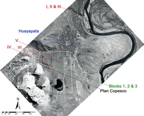
Air photo with areas of previous research at Pukara: Kidder 1939 excavations are marked in red; the multiple excavations at Huayapata are marked in blue; the general area of the Plan COPESCO excavations on the Qalasaya are marked in black; and the 2000-2001 fieldwork is marked in green (air photo from SAN, Peru). The limits of the site core are indicated in white.
Item record
Chapter
Ch. 03: Late Formative Period Ceramics from Pukara: Insights from Excavations on the Central Pampa
Item type
Photograph
Creator
Cultural terms
Pucara
Yaya-Mama
Geographic terms
Huayapata
Lake Titicaca Basin
Pukara
Qalasaya
Temporal terms
Late Formative 2
Late Formative 1
Early Intermediate Period (EIP)
Image contents
Object
Reuse
Copyright holder
Photo in possession of the author
Recommended citation
Isbell, William H.; Uribe, Mauricio I.; Tiballi, Anne; Edward P. Zegarra, 2018, "Visual database", https://doi.org/10.25346/S6/1B33FN.

