2.1
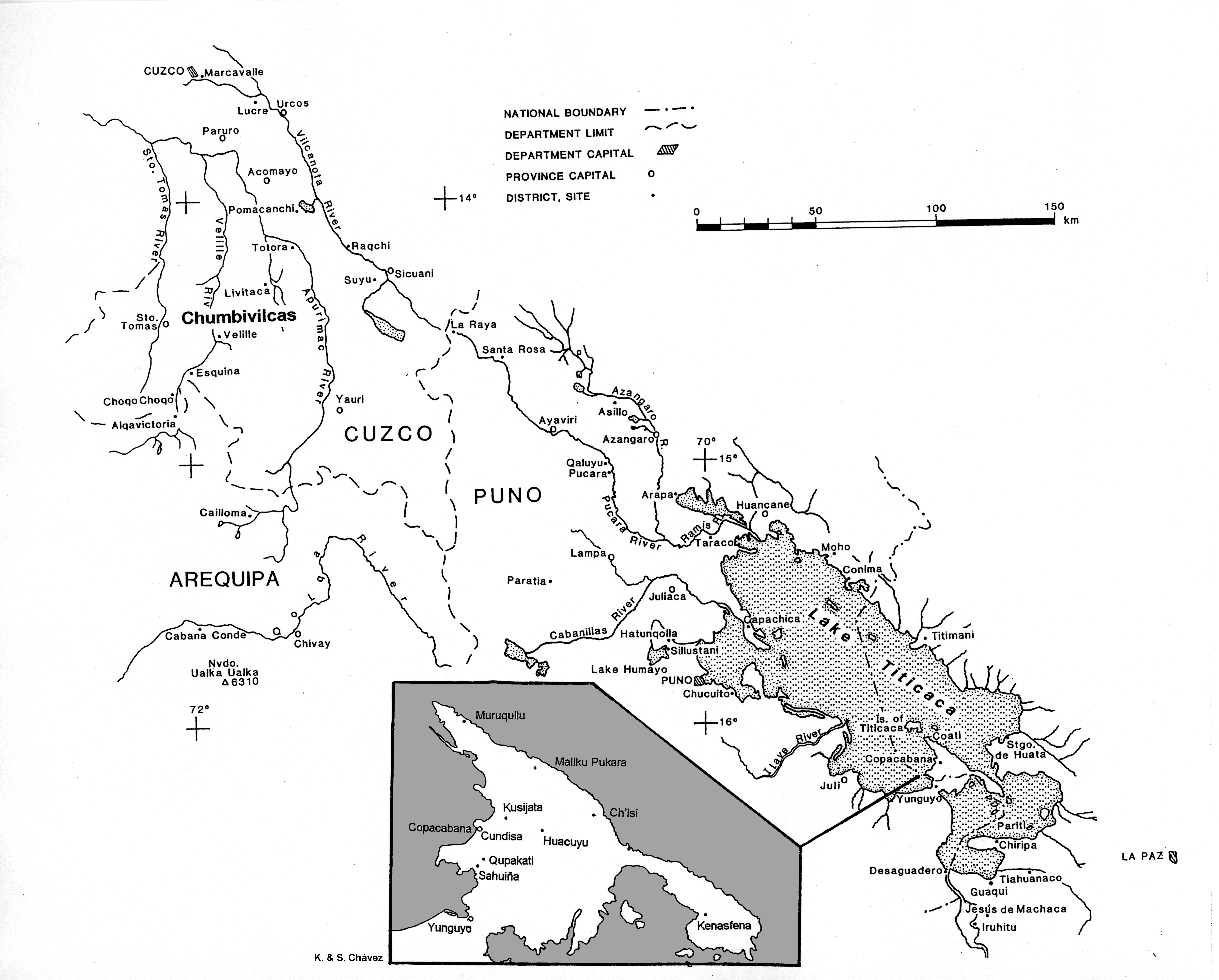
Map of the Cuzco and Titicaca Basins (with an inset of the Copacabana Peninsula), showing the sites mentioned in the text. Drawn by Sergio Chávez based on composite maps from the Instituto Geográfico Militar of Peru and Bolivia.
Item record
Chapter
Ch. 02: Identification, Definition, and Continuities of the Yaya-Mama Religious Tradition in the Titicaca Basin
Item type
Map
Creator
Cultural terms
Tiwanaku
Wari
Yaya-Mama
Geographic terms
Andean South America
Ch'isi
Chumbivilcas
Copacabana
Cundisa
Cuzco
Jesús de Machaca
La Paz
Lake Titicaca
Lake Titicaca Basin
Pariti Island
Pukara
Qaluyu
Santiago de Huata
Taraco
Tiwanaku
Temporal terms
Late Horizon
Early Intermediate Period (EIP)
Early Horizon (EH)
Middle Horizon (MH)>>Middle Horizon Epoch 3
Image contents
Object
Reuse
Copyright holder
Sergio J. Chávez
Recommended citation
Isbell, William H.; Uribe, Mauricio I.; Tiballi, Anne; Edward P. Zegarra, 2018, "Visual database", https://doi.org/10.25346/S6/1B33FN.